Transportation
County repairs landslide damage while protecting driver safety on California road
Summary
- After heavy rains inundated Northern California in the winter of 2022-23, San Mateo County needed urgent help to repair five landslides affecting Higgins Canyon Road in Half Moon Bay, California.
- We arrived at Higgins Canyon Road just a few hours after receiving the county’s initial call. Our in-house unmanned aerial systems (drone) survey team collected aerial photographs and LiDAR data immediately after the landslide movement began, saving precious time and keeping workers out of physical danger.
- We recommended road closures that would keep the public safe, characterized geologic conditions, and advised on repair designs. As work progressed and the rainy season continued, we monitored conditions and adjusted the approach as needed.
- By using drone surveys and consulting our nationwide, in-house geotechnical experts on design, we saved San Mateo County time and money on repairs. We also helped the county apply for Federal Emergency Management Agency (FEMA) funding for the project.
Client Challenge
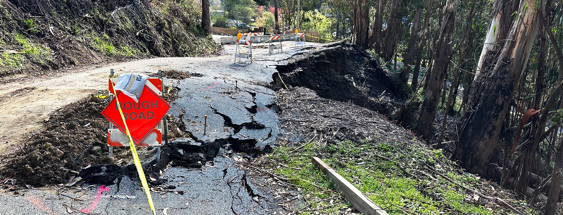
After heavy rains hit Northern California in the winter of 2022-23, San Mateo County needed urgent help to repair five landslides that damaged Higgins Canyon Road in Half Moon Bay, California. The rainstorms were so severe that FEMA declared them a federal disaster, and the embankment failures along the road made it dangerous to vehicles and pedestrians.
All five landslide sites needed individualized geotechnical assessments and repair designs, but San Mateo County had to act quickly to protect residents and travelers who used the road. And because the project was eligible for FEMA funding, San Mateo County needed a partner who knew how to communicate with the agency and work with its requirements. So the county turned to Haley & Aldrich.
Our Approach
We arrived at Higgins Canyon Road just a few hours after getting San Mateo County’s initial call in January 2023. In addition to boots-on-the-ground geologic mapping, our in-house drone survey team collected aerial photographs and LiDAR data immediately after the landslide movement began. We also performed subsurface explorations of each landslide site.
This team evaluated geologic hazards to inform repair designs and provide road closure recommendations — essential safety guidance both in the moment and as the hazards developed over the course of the rainy season. San Mateo County also relied on us to share site information with FEMA as part of its funding application.
At the most complicated site, a deep-seated landside destabilized a 130-foot-long segment of Higgins Canyon Road. There, we recommended a complete road closure to all through traffic, which kept detours manageable for residents. Our aerial mapping also revealed tension cracking 110 feet upslope of the road, an area identified as the upper limits of the main landslide. This area extended through private property and undermined an existing barn’s foundation.
To conduct repairs, stabilizing the hillside upslope of the road was necessary before excavating and reconstructing the road itself. Therefore, we recommended the installation of a soldier pile wall with temporary lagging to support the hillside, followed by the reconstruction of the road with a mechanically stabilized earth repair. This approach allowed the installation of a drainage system near the landslide plane, which would mitigate the high groundwater levels driving the landslide movement.
The county relied on us for continued monitoring throughout the rainy season. After the initial landslide in January 2023, the deep-seated landslide continued moving on the order of inches with each major atmospheric rainstorm. Haley & Aldrich revisited the site after each major downpour to collect new data and adjust geologic models and geotechnical recommendations as needed.
We also consulted on four other landslides that damaged the road — three along the downslope edge in one section and one near a creek, which caused significant erosion and collapsed 85 feet of the roadway, exposing subsurface utility lines.
Each of these sites required an individualized repair plan. At the spot with three adjacent landslides, we found unstable areas between each slide, which we determined would likely fail over time — turning three smaller landslides into one or two larger, more damaging ones. At this site, about 215 feet of the road needed to be stabilized to prevent further damage and restore the road shoulder. At the final site, environmental permitting proved to be our biggest challenge; because of the nearby creek channel, we had to not only repair the road but also restore the creek and its banks. We navigated the permitting agencies involved and found a design that would satisfy all stakeholders.
Value Delivered
- Arrived in the field within hours of San Mateo County’s initial call, beginning work as soon as possible
- Characterized geologic conditions and provided appropriate geotechnical recommendations for the roadway repairs
- Navigated environmental permitting constraints for a site along an active creek channel
For more information, contact:

Associate Geologist, Senior Project Manager

Senior Project Manager, Engineering Geologist

